|
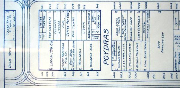
Block Bordered by Main, Commerce, Lamar, Poydras
All
illustrated retail storefronts now gone. The eastern end of this block was combined with the western end of the adjacent block
to the east (the block bordered by Main, Commerce, Poydras, Martin), by taking out Poydras Street.
At the same time,
the "new" Grififn (see "Pacific/Elm" images) was created by taking out storefronts 1008, 1010, and 1014 Main Steet and storefronts
1005, 1007, 1009, and 1011 Commerce Street.
This resulted in a new block bordered by Main, Commerce, Lamar, and the
"new" Griffin.
|
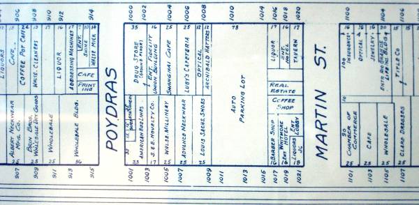
Block Bordered by Main, Commerce, Poydras, Martin
The
"new" Griffin (see "Pacific/Elm" images) was created by taking out storefronts 1008, 1010, and 1014 Main Steet and storefronts
1005, 1007, 1009, and 1011 Commerce Street.
At the same time, the eastern end of this block was merged with the western
end of the adjacent block to the east (the block bordered by Main, Commerce, Martin, Murphy) by taking out Martin Street.
This
resulted in a new block bordered by Main, Commerce, the "new" Griffin, and Murphy. However, Murphy Street was converted to
a pedestrian walkway. The final resulting block is bordered by Main, Commerce, the "new" Griffin, and Field.
|
|
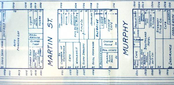
Block Bordered by Main, Commerce, Martin, Murphy
Martin
Street disappeared with the merger of the western end of this block with the eastern end of the adjacent block to the west
(the block bordered by Main, Commerce, Poydras, and Martin). Murphy Steet was converted to a pedestrian walkway. The final
result is a block bordered by Main, Commerce, the "new" Griffin, and Field.
|
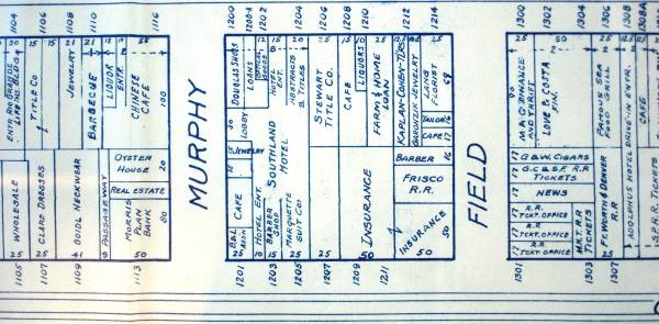
Block Bordered by Main, Commerce, Murphy, Field
Murphy
Street disappeared with the merger of the western end of this block with the eastern end of the adjacent block to the west
(the block bordered by Main, Commerce, Martin, and Murphy). Murphy Steet was converted to a pedestrian walkway. The final
result is a block bordered by Main, Commerce, the "new" Griffin, and Field.
|
|
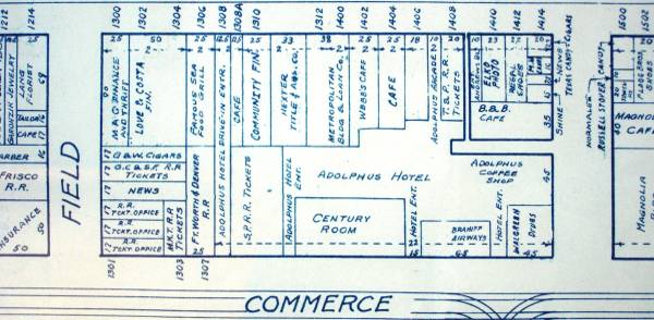
Block Bordered by Main, Commerce, Field, Akard
Many
of the illustrated retail storefronts are gone. They include storefronts in the mid-block and northeast areas fronting Main
Street, and most of the few storefronts facing Commerce (mostly re-allocated to support the Adophus Hotel).
|
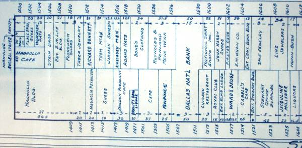
Block Bordered by Main, Commerce, Akard, Ervay - Western
End
The storefronts from 1500 Main Street (the northwest corner) to 1530 Main Street (the Dallas National Bank Building)
are gone and have been replaced with an urban park. 1415 Elm Street is also an open area in support of the conversion of
the Magnolia (oil company) Building, 1401 Commerce Steet, to residential. The Magnolia Building was built in 1923 to a height
of 29 stories. At that time it was the tallest building in Texas, and also west of the Mississippi River.
What many
do not know is that a spring exists below the park area on Main Street. It is believed that the spring generates enough
flow to support the fountains, were the city to cut off the park's city water supply. There is a "mythological" link of
the spring, Medusa, and the Flying Red Horse of the Magnolia Building.
|
|
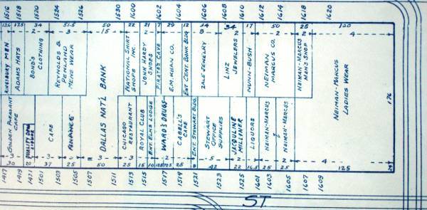
Block Bordered by Main, Commerce, Akard, Ervay - Eastern
End
1513 Commerce thru 1601 Commerce were taken out to create a parking lot for Neiman-Marcus. Many believe that
Stanley Marcus' insistance on keeping the downtown store open when the downtown environment was at it's lowest, contributed
greatly to salvaging the Business District.
|
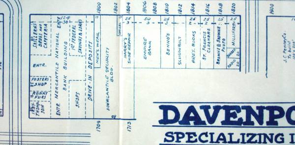
Block Bordered by Main, Commerce, Ervay, St Paul
Except
for storefronts in support of the Mercantile National Bank Building, all illustrated retail storefronts are gone. The original
Mercantile National Bank Building, 1700 Main Street, was constructed in 1942 and at 33 stories, took the "tallest" building
title away from the Magnolia Building.
|
| |
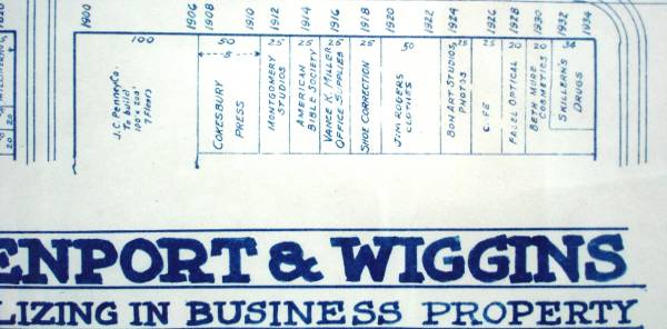
Blocks Bordered by Main, Commerce, St Paul, Harwood
All
of the illustrated retail storefront are gone, except a few on the eastern end, facing Main Street.
|
|
|
|